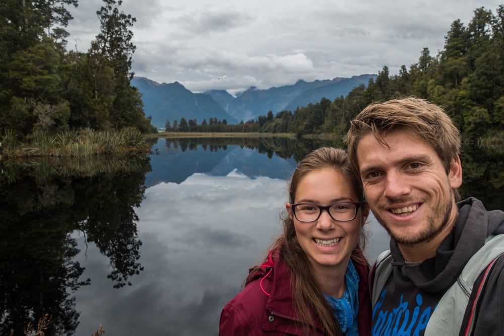
After visiting the cute and cosy town of Wanaka, we continued our New Zealand road trip to the Fox Glacier area. We stayed at the Fox Glacier Top 10 Holiday Park for one night while exploring the area. As you can see on the map on the right, its location is great, pretty much in the middle of all the activities we planned on doing in the Fox Glacier Area. We would be hiking the Fox Glacier Valley Walk, the Minnehaha (Glow Worm) Walk, and the Lake Matheson Walk, and watch the sunset at the Peak Viewpoint.
Read all about our hikes in the Fox Glacier area below.
Hiking the Fox Glacier Valley Walk
The first hike on our Fox Glacier itinerary was the Fox Glacier Valley Walk. The car park at the trailhead is about a 10 minute drive from our campsite, 4 km off the main road.


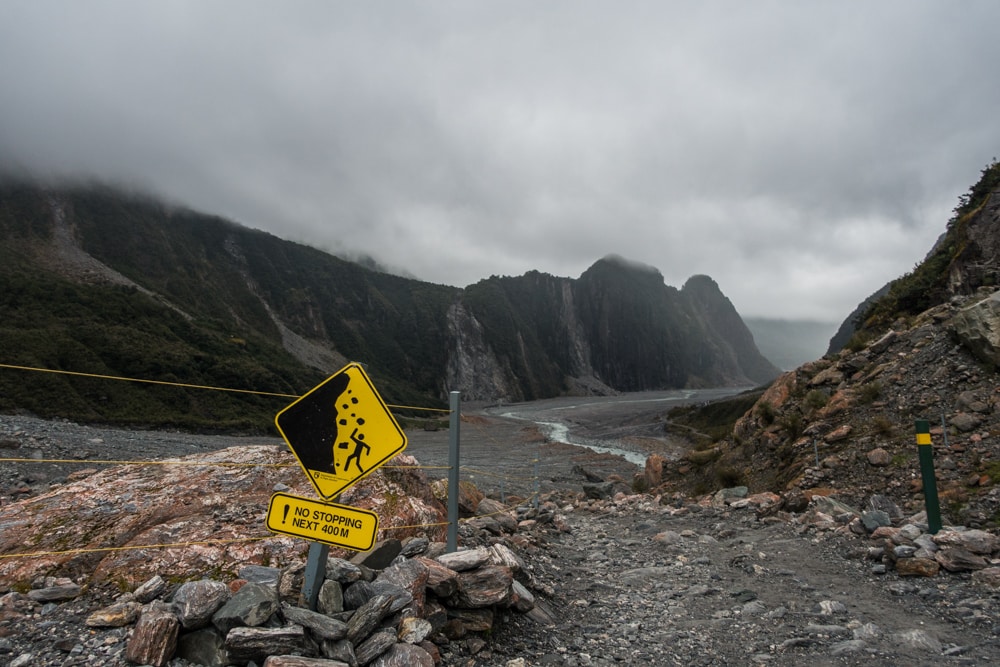
You’ll see a sign marking the spot where the Fox Glacier used to end. It’s fascinating, confronting, and a bit sad, but the truth: the glacier is retreating. This means it is constantly moving: ice and rock may fall down without warning, and the weather and water levels can change quickly. The track conditions change daily (sometimes even faster), so rangers inspect and mark the path each morning. For your own safety: heed all signs and barriers! People have died here.
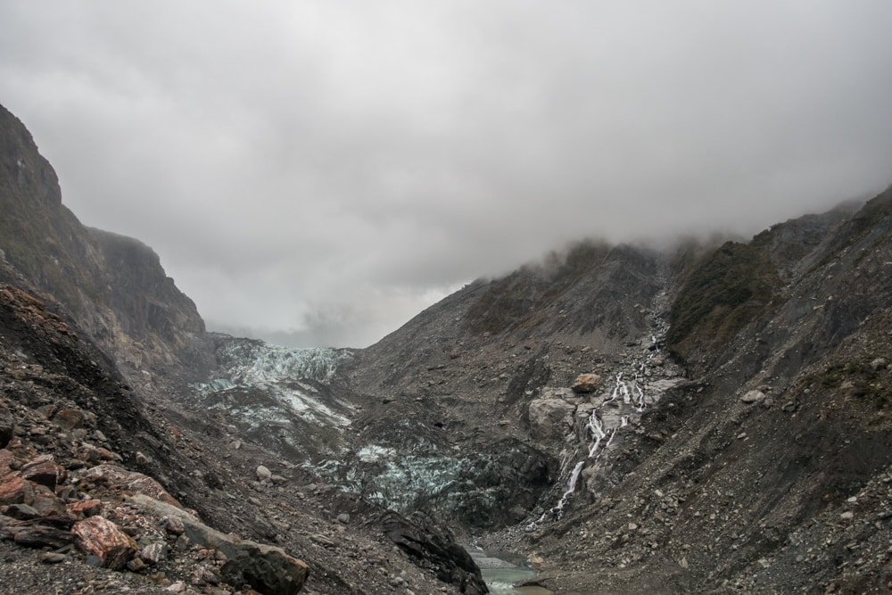
The Fox Glacier Valley track is a (nearly) 3 km return track, which took us about an hour to complete, including a 10 minute break at the viewpoint. You’re walking in open riverbed, exposed to the weather, so dress accordingly. The hike takes you over rough and uneven ground, up to the viewpoint over the Fox Glacier. We had to cross some sidestreams and climb a pretty steep slope to get there. There’s even an area with signs forbidding you to stop there.
Before 2013 the hike was easy, without that steep slope. By then the Flox Glacier had retreated so far they had to change the viewpoint to the top instead of the start of that slope. At the rate things are deteriorating they’ll have the extend the path even further soon.

Don’t forget to check if the track is open before going there, as they sometimes close it due to ice collapse, flooding or landslides. You can do so on the Department of Conservation website.
Hiking the Minnehaha (Glow Worm) Walk
That same night, after dark, we went searching for glow worms on the Minnehaha Walk. It was only a 2 minute drive from our campsite, starting right off the main road. We parked alongside State Highway 6, right after Bella Vista Motel (when you’re coming from the town centre), at the sign saying “Te Weheka Walkway/Cycleway”. There’s no real car park.
The Minnehaha Walk is a short and easy loop walk, following a stream through a rainforest. We forgot to time how long it took us, but according to the DoC website it’s a 20 minute walk. We went after dark, when the glow worms are out. Do bring a torch to watch where you’re going, or you might find yourself standing (or lying) in the stream instead of on the path.

To see the glow worms, best turn off your torch. They’re not everywhere, lighting up the entire forest like I expected, but seem to huddle together in certain spots. We read beforehand that sudden loud noises tend to make them glow brighter. Other hikers might have wondered what the hell we where doing, but it worked! Or at least we believed it did. I have to admit I was a bit scared at the start, walking through a pitch black forest, but the glow worms will make your forget the scary part.
Hiking the Lake Matheson Walk
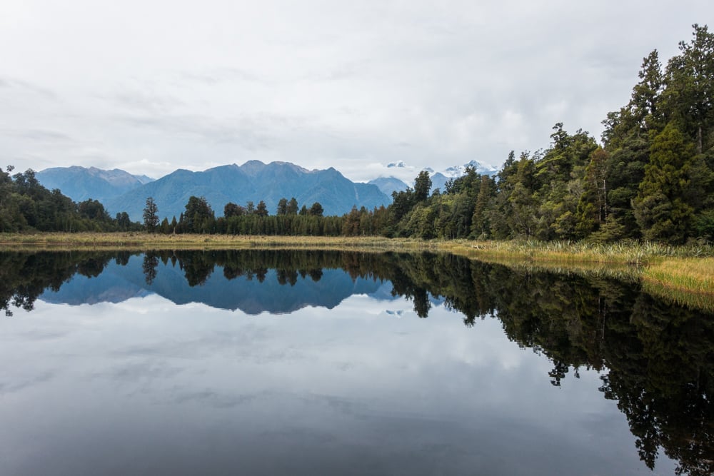
Lake Matheson often makes it to lists of the world’s most beautiful lakes, and rightfully so. It’s famous for its jaw-dropping reflections of New Zealand’s highest mountains: Mount Cook and Mount Tasman. To behold this with your own eyes, you have to hike the Lake Matheson Walk. The trailhead was a 5 minute drive from our campsite.

The Lake Matheson Walk is one of the most popular walks on the West Coast, so expect a lot of tour busses. Lots of people choose to walk to the Jetty Viewpoint and back, which is 40 minute return walk. We decided to walk the Lake Circuit instead, which is less crowded. This track is a 2.6 km loop, taking you all the way around Lake Matheson, through the forest surrounding it. It took us 1.5 hours to complete, including a second visit to the Jetty Viewpoint. It’s an easy, pretty flat walk.

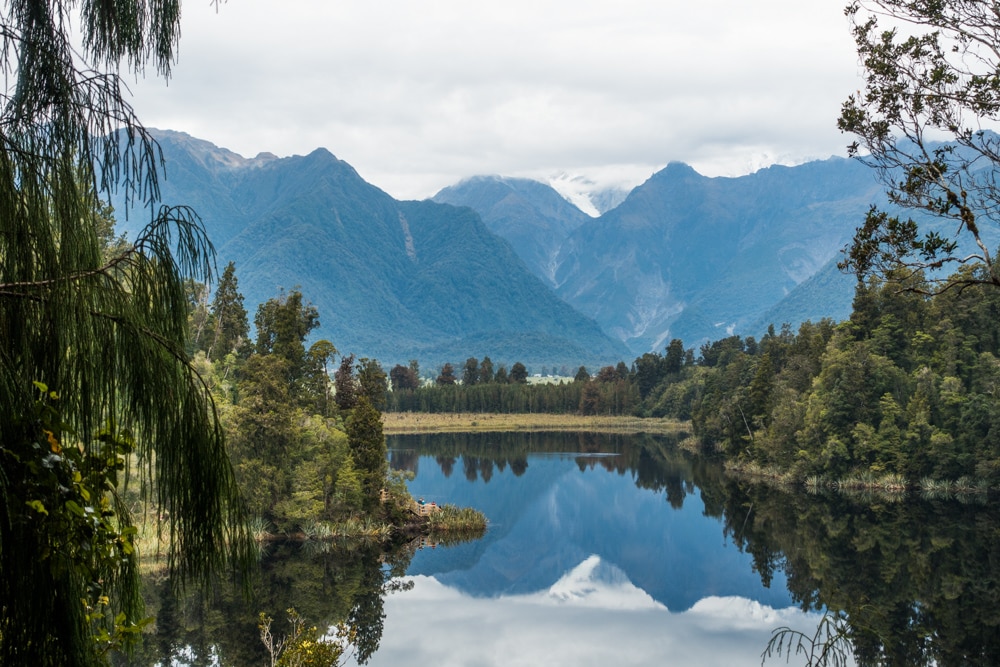
We walked the Lake Matheson walk in clockwise direction, passing the popular Jetty Viewpoint first. It’s not a coincidence this is the most popular viewpoint, the lake perfectly mirrors the snow capped mountains and trees surrounding the lake. Did you know that this reflection looks so great thanks to the dark brown colour (coming from the humus of the forest floor) of the water? After we completed the walk around the lake, the sky had cleared a bit, so we returned to the Jetty Viewpoint a second time. There were less clouds, but unfortunately still no sun.

After the Jetty Viewpoint we didn’t see many people. We did a short detour to the View of Views Viewpoint over a return path away from the loop. It’s a short climb up some stairs. From there you can see the next viewpoint: Island of Reflection. This is a gorgeous viewpoint, with a short jetty taking you out on top of the lake. It might just offer the best view of all three. Be careful not to fall in when you’re snapping some great photos, as there’s no railing. Too bad it wasn’t a bit sunnier while we were there. On the other hand, the clouds around the top of the mountains have a certain charm as well.
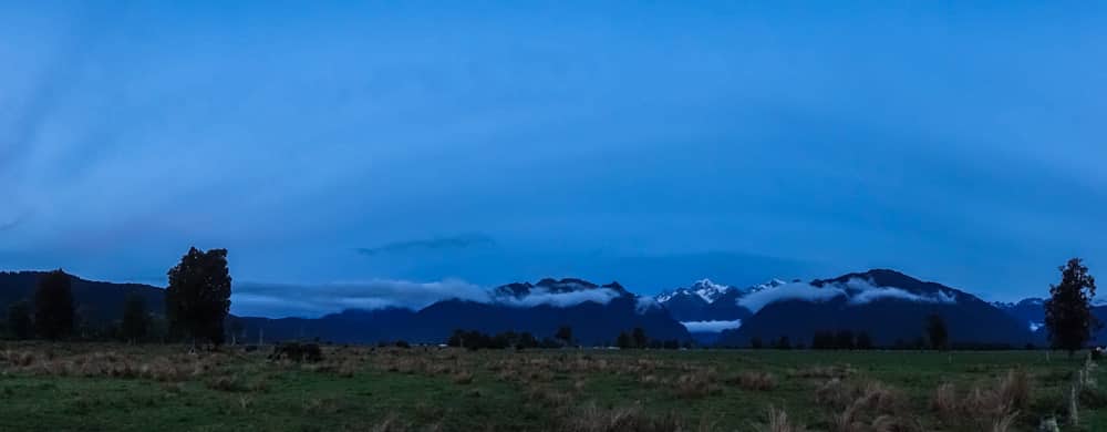
The Peak Viewpoint
The Peak Viewpoint provides a stunning view of the Southern Alps and Fox Glacier, including New Zealand’s highest mountain peak: Mount Cook/Aoraki. A strange viewing device helps you put names to the mountains and peaks you see all around you. It was only a 5 minute drive from our campsite and definitely worth a visit! Sunset is the best time, but we were a tad late. We found this hidden gem in Scott’s NZ Frenzy guidebook.

We had a great time in Fox Glacier! If you don’t have a lot of time, we recommend walking to the Jetty Viewpoint at Lake Matheson and having a look at the Peak Viewpoint. If you have as much time as we did, about 24 hours including the night, they’re all worth a visit!

Liked this post?
We hope you enjoyed our post about hiking and exploring the Fox Glacier area. Did we miss anything? Let us know in the comments. Did you find it helpful? Help us spread the word by sharing this post or pinning the following image.

What a great experience – glacier, beautiful lake and even glow worms all at the same place! If I remember well we only did the Lake Matheson walk when we visited, but it’s so long ago that I only ‘remember’ it from the pictures. We loved New Zealand, but had 3,5 weeks for both islands so it was a bit rushed and we concentrated on the musts only. How much time did you spend there?
We only spent 4 weeks in New Zealand, so had to skip some things too. Anyway, now we have an excuse to go back someday. 😉 We loved Lake Matheson, it was definitely the most impressive view in Fox Glacier, so you made a good choice. 🙂
Looks like you managed to fit quite a few spectacular views into one day!
I visited Fox Glacier back in 2011, and I wonder how different it would look to me now. Bit scary how fast it’s melting!
Yes we did, Emily! 🙂 You visited in 2011? That should be a pretty different view, I guess. You didn’t have to hike the steep slope back then if I’m correct, you were still standing at the bottom of the glacier, no? Yep, it is kind of scary…