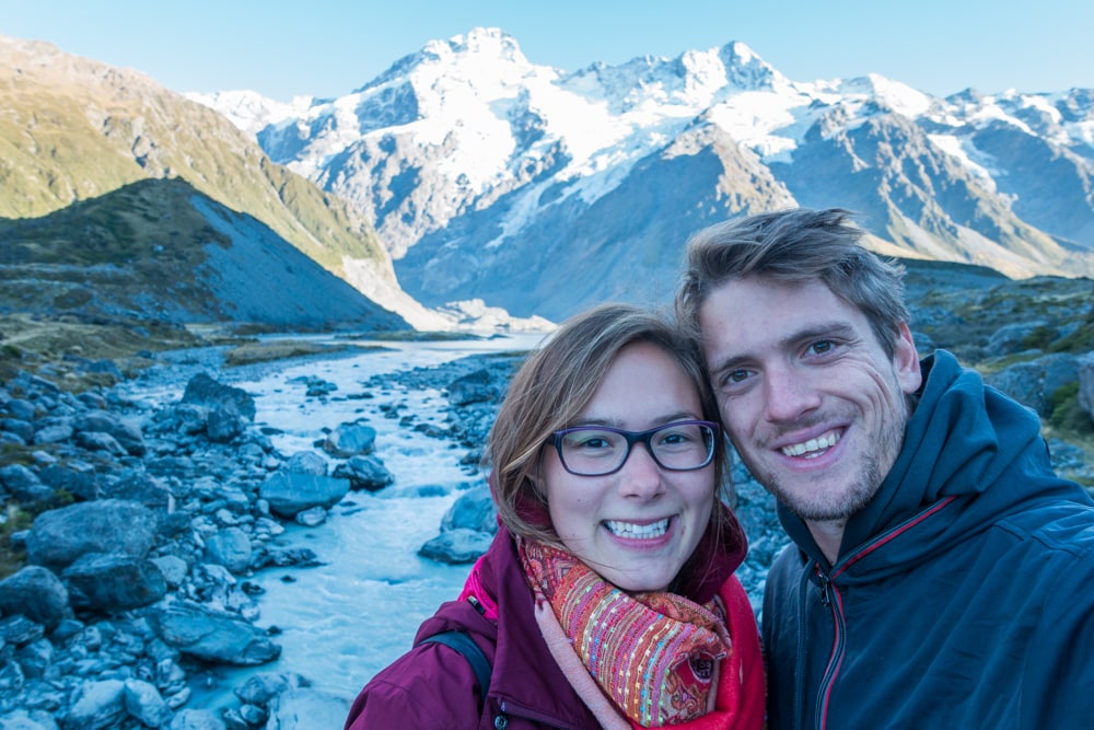
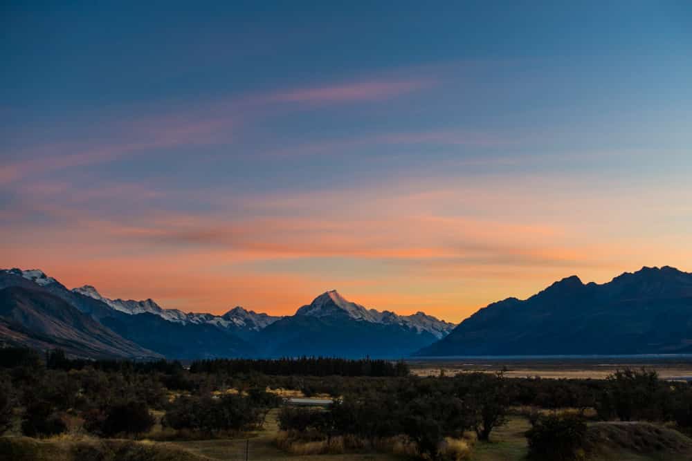
Mount Cook, known as Aoraki by Māori, is New Zealand’s highest mountain and part of Aoraki/Mount Cook National Park. Hunting for geocaches in the area led us to several stunning viewpoints of the mountain ranges. Apart from 19 peaks over 3,000 meters high, the national park houses some glaciers and glacier lakes as well. A 3 hour hike through the Hooker Valley led us to the Hooker Glacier and a short but steep climb took us to a viewpoint over the Tasman Glacier.
In this blogpost we’ll tell you all about what to explore and where to hike in the Mount Cook area.
During our visit to the Mount Cook area, we stayed at Glentanner Holiday Park Mount Cook, but more on that later.
Visit some beautiful Mount Cook viewpoints
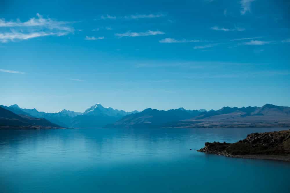
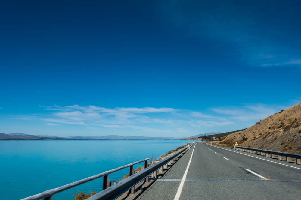
Peter's Lookout is a must stop spot on your way to Mount Cook. It’s situated on the edge of a stunningly blue lake, Lake Pukaki, looking out on Mount Cook. The view is amazing, and it wasn’t flooded with tourists. Perfect conditions for a geocache!


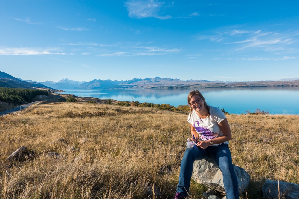
Another geocache hunt took us to the Mount Cook Lookout, another viewpoint on the shores of Lake Pukaki. We parked next to the main road and climbed up to the geocache. Other visitors drove all the way to the edge of the lake over an unsealed road to end up at an amazing spot for a picnic.
Hike the Hooker Valley Track
Both of those Mount Cook viewpoints are on the southern shores of Lake Pukaki. On the northern shores there’s Mount Cook, the alpine village. It covers the area between Lake Pukaki and Aoraki/Mount Cook National Park. The Hooker Valley Track is one of the Aoraki/Mount Cook village walking tracks that start around the village and provide views of Mount Cook and the surrounding area.

The marker on the map on the right called Hooker Valley Track points to the car park at the trailhead. We started walking at about 8:55 and were back at our campervan at 12:05, meaning it took us just over 3 hours to complete this return track. That includes a detour to the other side of Hooker Lake. There’s only an 80m height gain over 5 km (one way to Hooker Lake), so the track is rather flat.
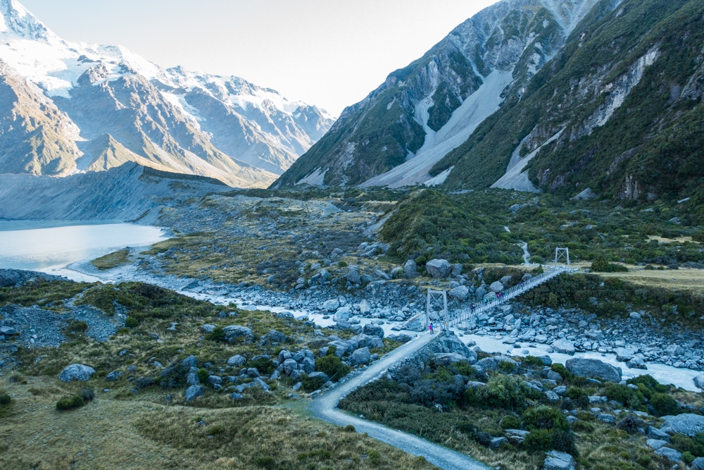
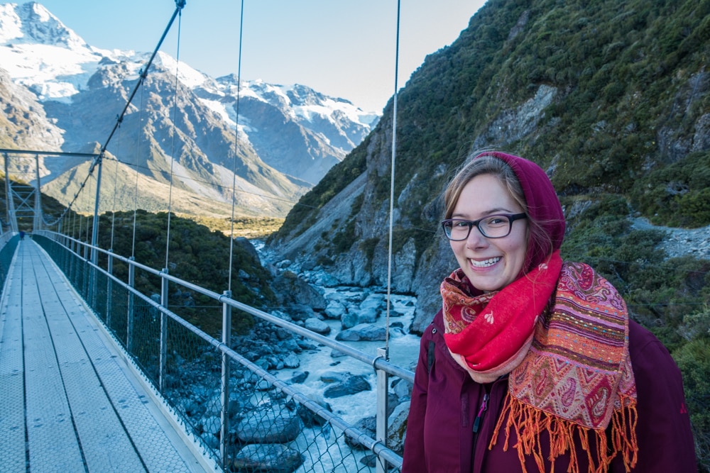
While hiking the Hooker Valley Track you’ll have to cross the Hooker River on three different spots, twice. No need to bring your swimwear, swing bridges are provided to get to the other side of the fiercely flowing grey/white water. Before you reach the first swing bridge, you’ll come across the Meuller Lake Lookout. You’ll see Meuller Lake and Meuller Glacier against a backdrop of snowcapped mountains, and hear the Hooker River make its way through the valley. When you look the other way, you’ll see a blue lake in the distance. Lake Pukaki, if we’re not mistaken.


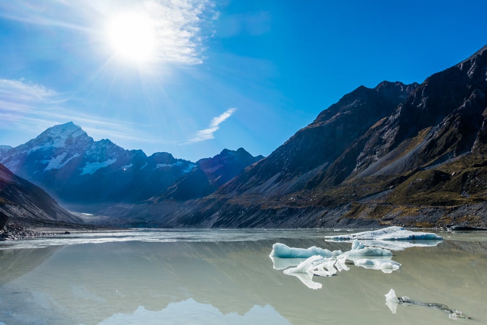
At 10:25 we arrived at the end of the path, at the edge of Hooker Lake, where you can see Hooker Glacier. There are a couple of picnic tables at the lookout, and probably a bunch of people too, as this is one of the most popular hikes in the area. Hooker Lake is grey and the pieces of ice floating in it look small, until you notice the size of the people on the shore. We took a 10 minute break to enjoy the view with a cookie before heading back to the car park.
Right behind the first swing bridge you encounter when heading back to the car park, there’s the start of a short detour, leading to the other side of Hooker Lake. Just take the small path on your right, leading you along the Hooker River to the edge of Hooker Lake in about 10 minutes. The path isn’t well maintained, but it takes you to a nice spot, right where the river flows from the lake, where there’s no one around. You can see Hooker Lake and Hooker Glacier from another angle, and if you look closely you’ll see the people near the picnic tables as well. Be careful though, from May to November there’s an avalanche hazard at the end of the path.


We were there in April, in the fall, and our advice is: the earlier you start the Hooker Valley Track, the warmer you should dress, as larger parts of the path will be covered in shade. Most of our body parts were shielded from the cold by clothes, but our ears, nose and hands were freezing during the first part of the hike. Golden tip: keep an eye on the snow on top of the mountains while you’re walking. When you suddenly hear a thundering sound, you can spot an avalanche. It happens quickly, so it’s hard to find the falling snow before it’s over, but it’s so cool! We heard it happen twice during our hike, but only saw it once.
The Hooker Valley Track is probably our second favourite hike in New Zealand, right behind the Tongariro Alpine Crossing. The views are amazing, and the hike isn’t too hard. I loved the views when we were walking over the boardwalk between the tussock, with Mount Cook in front of us. Brecht liked the swing bridges the most. I thought they were a little scary, especially when Brecht started jumping around on them! Even though I complained a lot during the short detour we took to the other side of Hooker Lake, it’s truly a beautiful spot. We still can’t believe how beautiful New Zealand is.

Discover Tasman Glacier Lake
A short but exhausting stair climb takes you to the Tasman Glacier viewpoint. It’s one of the Tasman Valley walking tracks. The marker called Tasman Glacier Lake points to the car park where these tracks start.
Before reaching the Tasman Glacier viewpoint, you’ll pass a viewpoint watching over the Blue Lakes. They lost their clear turquoise colour, because there’s no glacier meltwater flowing into the lakes anymore. Rainwater feeds the lakes now, giving the lakes an (ugly) greenish colour.


To get from the car park to the Tasman Glacier viewpoint, you’ll have to conquer 15 minutes worth of steep stairs. I hated it. And frankly, I wasn’t that impressed with my reward: the view over Tasman Lake and what’s left of Tasman Glacier. Tasman Lake is grey because of the Tasman Glacier meltwater feeding it. If I understood the information signs correctly, Tasman Lake can become a clear turquoise lake when the glacier flour is settled.
Aoraki/Mount Cook National Park is definitely worth a visit when you find yourself on the south island of New Zealand. The views from different spots looking out on Mount Cook and the Southern Alps are simply stunning, and Lake Pukaki is so blue you hardly believe it when you see it with your own eyes. The Hooker Valley Track is one of our favourite hikes throughout all of New Zealand. And we did our fair share of hikes. Top activity in New Zealand: enjoying its beautiful nature, no matter where you are.

Liked this post?
We hope you enjoyed our post about exploring and hiking Mount Cook. Did we miss anything? Let us know in the comments. Did you find it helpful? Help us spread the word by sharing this post or pinning the following image.

Wauw! So beautiful!
Thank you for a nice post, very helpful information, God bless you!
Glad to hear you found this post helpful, Oskar. Thanks for commenting!
Thanks for posting, Birthe! I really enjoyed the tramp back in 2018 and I so wish to visit New Zealand once again!
Same here, a great hike! And New Zealand is just gorgeous, we’ll definitely visit again someday!