
In huge cities there are often plenty of transportation options available: take a cab, a bus or the tube, hire a bicycle or maybe just walk. But figuring out which of these options is the fastest or cheapest is something else. In those situations, Citymapper is exactly what you need.
Citymapper is a website with accompanying mobile app that gives you the best options for getting from point A to point B in one of the cities it supports. Enter your start and end point and it will calculate how long it will take you to get there by foot, bicycle, cab, bus, metro, train or whatever is available.
Let’s say you’ve just arrived at King’s Cross Station in London and would like to do some shopping at Harrods. Just enter those as your start and end point and Citymapper will return something like this:
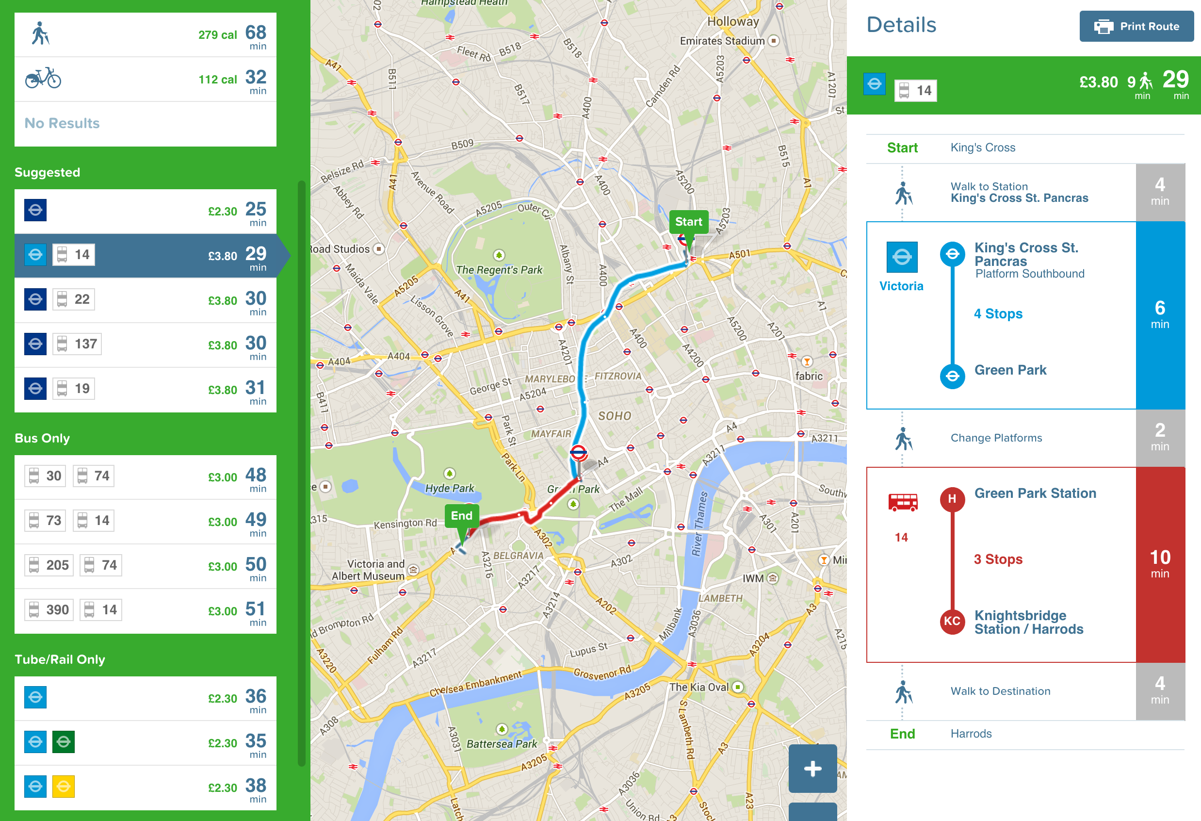
Every option has its time and cost (either in calories or money) and can be clicked on for a nice overview on the map and all the details you need. It’s also possible to set a specific time of arrival, which is perfect for any appointments across the city.
Another useful feature is the “Meet Me Somewhere” feature, which allows you to share a location with anyone without having to look for street names. You’ll get a unique link you can share and can be used to get a route to that location.
Unfortunately Citymapper is only available in a small selection of cities for now, but they are expanding to new cities frequently. Vote for your city today.