Australia’s Red Centre is the dry desert in the middle of the country. There you’ll find the icon of Australia and the pride of the Northern Territory: Uluru, the big red rock. Although this natural wonder is the most famous feature in the Red Centre, there are a lot of other very peculiar and breathtaking sights to be found. We particularly loved Kings Canyon and Kata Tjuta, spent some time in Alice Springs, and were amazed by Karlu Karlu, better known as Devils Marbles.
In this blogpost we’ll tell you all you want to know (and probably more) about these must-see landmarks you’ll pass on your road trip through this red sanded part of the Australian Outback. At Kings Canyon and Uluru-Kata Tjuta we did some great hikes to stunning views, and in Alice Springs we encountered Australian native wildlife. We only made a short stop at Karlu Karlu to snap some pictures and learn about the way these boulders came to be, which was enough to be impressed.
Kings Canyon

Kings Canyon is situated in Watarrka National Park in the Northern Territory. We did three walks there: the Kings Canyon Rim Walk, the Kings Creek Walk and the Kathleen Springs Walk. Important to note is, when the forecast temperature for Watarrka National Park is 36°C or above, the Rim Walk closes at 9h00. All other walks remain open at all times, but they recommend to avoid walking during the hottest times of the day. We did the Kathleen Springs Walk and the Kings Creek Walk in the late afternoon when we arrived at the park. Both walks are rather short and quite easy, just make sure to wear a hat, sunscreen, and bring enough water. A flynet is a nice (not in the sense of beautiful or cool, quite the opposite) accessory as well, if you don’t want to be bothered by those annoying flies that seem to rule Australia’s Red Centre. We bought ours for $9.95 each at the Kings Canyon Resort souvenir shop, but discovered later they only cost $4.95 at the Ayers Rock Campground reception.
Upon arrival at the Kings Canyon Resort we asked the lady at the reception which walk she would recommend for us to do that afternoon. She suggested the Kings Creek Walk. Nevertheless we decided to do the Kathleen Springs Walk, thinking we would see Kings Canyon the next day during the Kings Canyon Rim Walk. We arrived at the Kathleen Springs Carpark just before 17h, after a 20 minute drive from the resort.


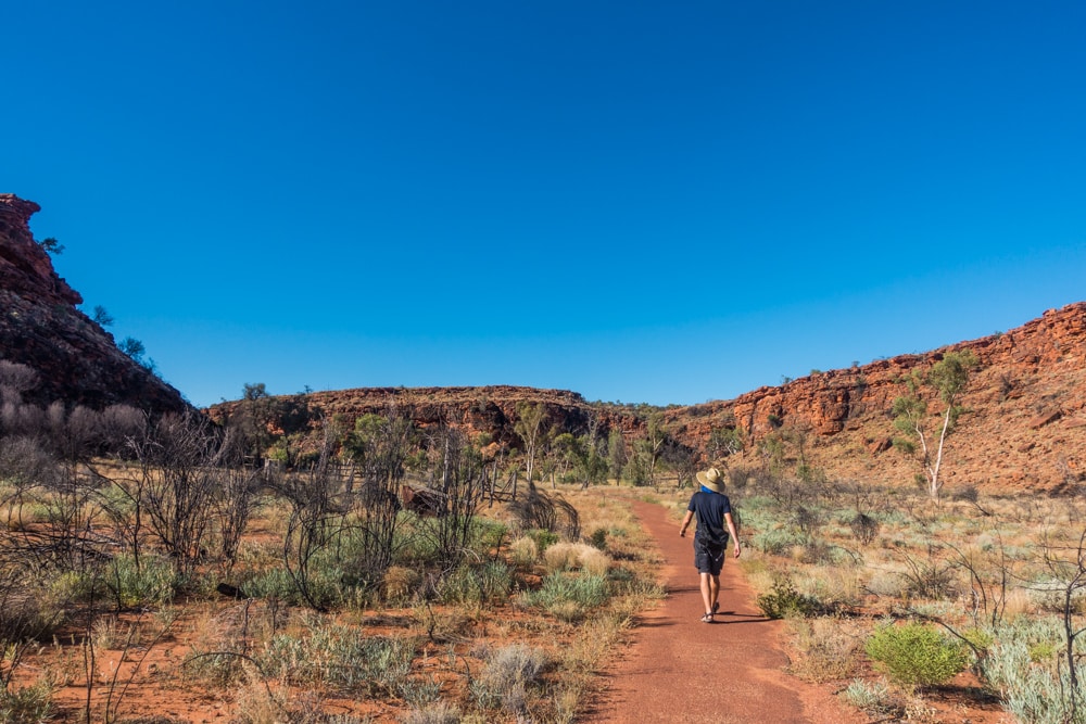
The track is easy, advertised as great for the whole family. It’s a 2.6 km return walk, with a spring-fed waterhole at the end. Along the paved walkway are information signs on the Aboriginal Culture and recent cattle industry, marking points significant to the story. You’ll see the dry riverbed of the Kathleen Creek, winding its way into the George Gill Range, before ending up at the waterhole. The permanent water here attracts animals, thus making for a popular hunting spot for the Aboriginals. Parts of the path are shaded, and there are benches at the waterhole to relax and soak in the peace and quiet of this relatively cool place. All in all it took us about 50 minutes to do the Kathleen Springs Walk, meaning we still had time and energy to do the Kings Creek Walk.
We drove over to the Kings Canyon Carpark, where both the Kings Canyon Rim Walk and the Kings Creek Walk start. This walk is a 2.6 km return walk as well, taking you along Kings Creek, running through the canyon. The walk is rather easy, but only partly paved. At a certain point you’ll have to walk over rocks instead of a path, so mind your footwear. Along the path are again information signs on the Aboriginal Culture and the fauna and flora in Kings Canyon. You’ll pass some benches as well, if you need a rest or just want to enjoy the beautiful nature surrounding you. At the end of the path you’ll find a viewing platform, providing an amazing view of the canyon walls. It took us 40 minutes to complete the Kings Creek Walk, before heading back to the resort for dinner.


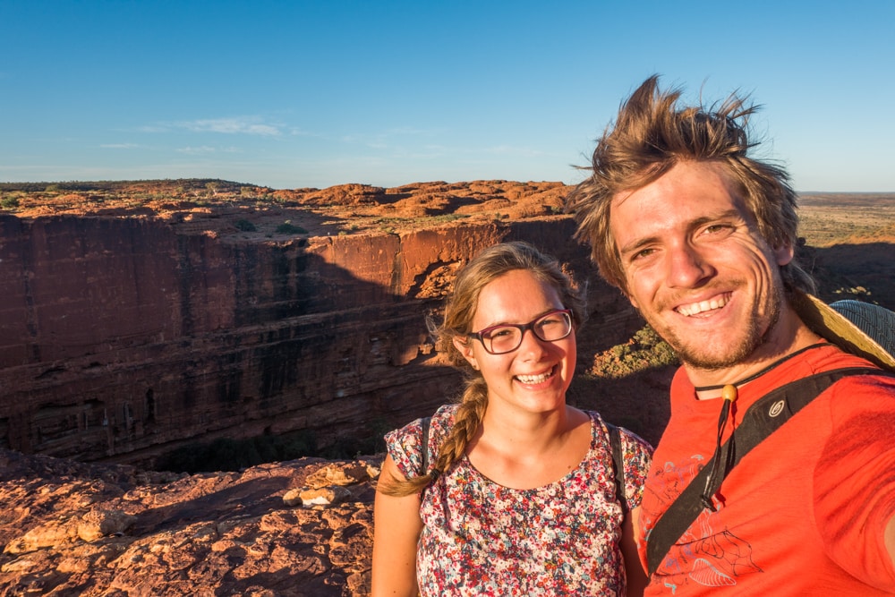
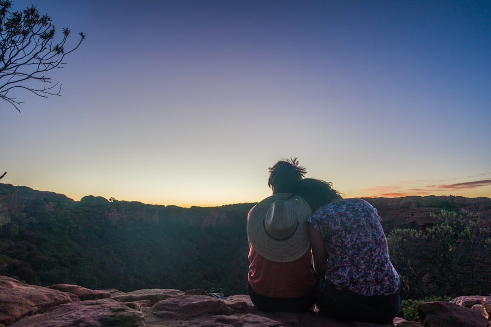
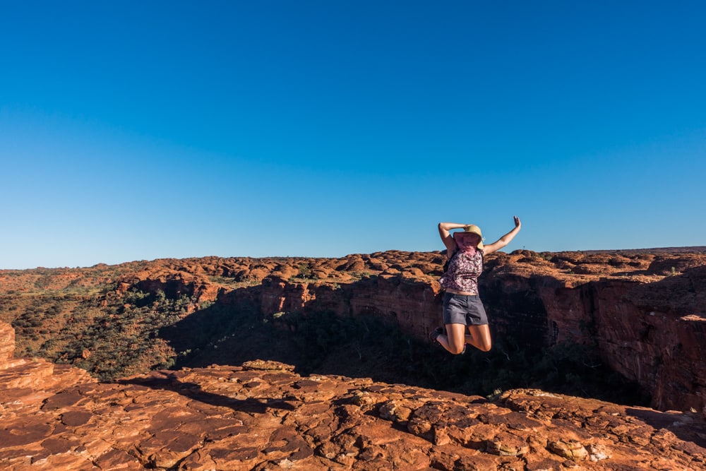
After a good night’s rest we got up at 5h to see the sunrise from the top of Kings Canyon. The start of the Kings Canyon Rim Walk is a steep climb to the top of the canyon. Even though it was only 5h40 and still dark when we started the walk, it was already starting to get hot. We let our eyes adjust to the darkness, but brought a flashlight just in case. By 6h10 we were the first people to reach the top, right on time to watch the beautiful sunrise. We had breakfast on the way, and brought some snacks and 3 liters of water per person (1 liter per person per hour). We wore our brand new hats and flynets, a coat of sunscreen and decent shoes.
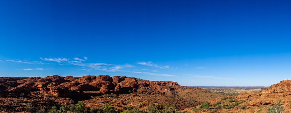
The Kings Canyon Rim Walk has to be walked in clockwise direction, with the steep climb in the beginning. This means you do the hardest part at the coolest time. Trust us when we say you can’t start early enough when you visit in the summer months, like we did. The loop is 6 km long, taking you along the edges on top of the canyon, past great viewpoints. There are almost no fences to be found, which makes for great pictures, but scary thoughts as well. I always picture worst case scenarios in those moments: I see myself falling of the cliff, or worse, I see Brecht falling. Nevertheless, it was a great walk! It’s what I call adventurous. Not extremely adventurous or dangerous, but there’s a bit of challenge during the walk which makes it fun.


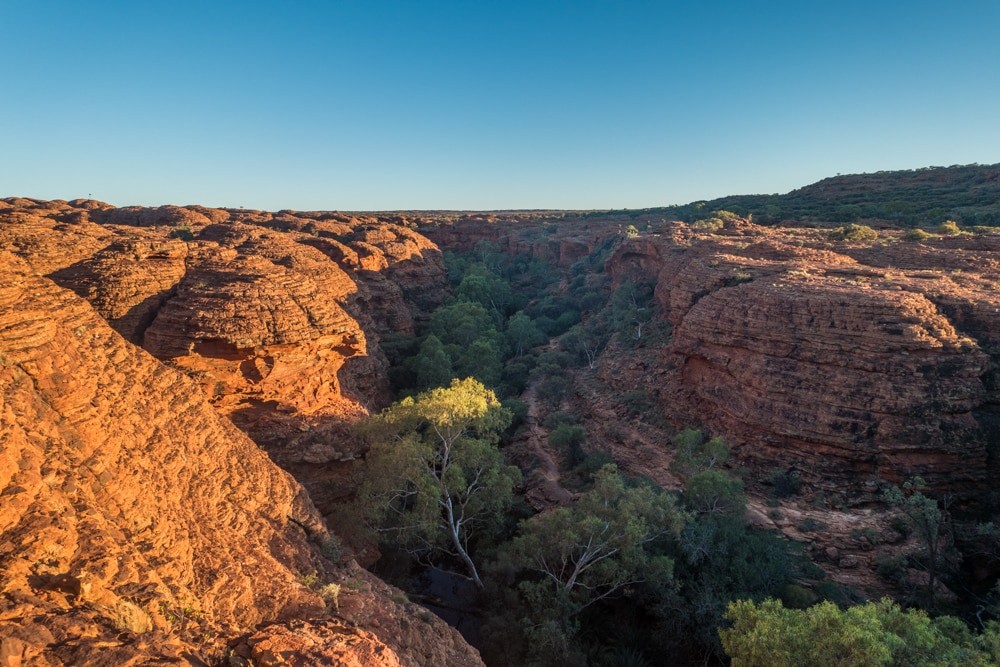
The Kings Canyon Rim Walk passes through a maze of weathered sandstone domes, which was really cool. The walk has some short return detours as well, like the ones to Cotterills Lookout and the Garden of Eden. Cotterills Bridge took us to a point overlooking the canyon walls, and the Garden of Eden is a lush oasis leading to a waterhole. It’s a nice and peaceful place, where the beautiful canyon walls tower above you on all sides. At 7h40 in the morning the place was totally in the shade, perfect for a short break to eat a snack and cool down. After climbing the stairs back up to the top of the canyon you’ll pass some more great views before starting the slow descent back to the carpark. The whole walk took us just over 3 hours to complete, including about a 30 minute break to watch the sunrise.
The Kings Canyon Rim Walk is by far the most beautiful and fun walk of the three, definitely worth the steep climb at the start. If you have time for one more walk we’d recommend the Kings Creek Walk instead of the Kathleen Springs Walk, as it’s more adventurous, thus more fun. Even if you are doing the Rim Walk, we recommend to do the Kings Creek Walk, as it provides a very different perspective on the canyon. Happy hiking!

Uluru and Kata Tjuta
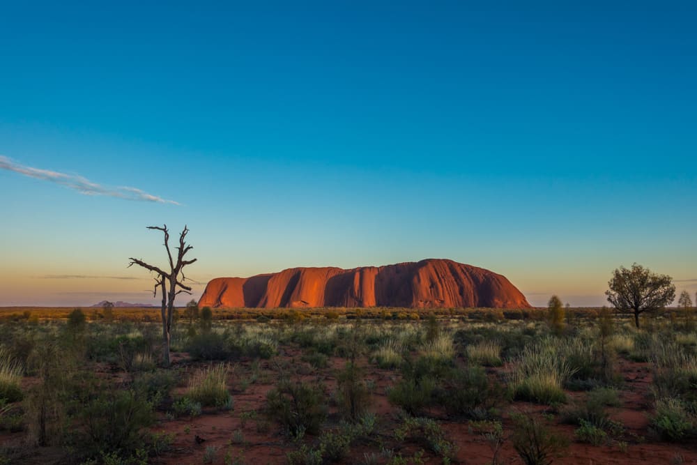
After the Kings Canyon Rim Walk we drove over to the Ayers Rock Campground, where we would stay for three nights to explore Uluru-Kata Tjuta National Park. Uluru, or Ayers Rock, is the big red rock sprouting out of the ground in the middle of nowhere. Although you might not know the name, you would definitely recognise it when you see a photo. The less famous part of Uluru-Kata Tjuta National Park is Kata Tjuta, or The Olgas. This doesn’t mean that it’s less amazing. Quite the opposite, in certain ways Kata Tjuta, with its 36 domes, is even more impressive than Uluru.
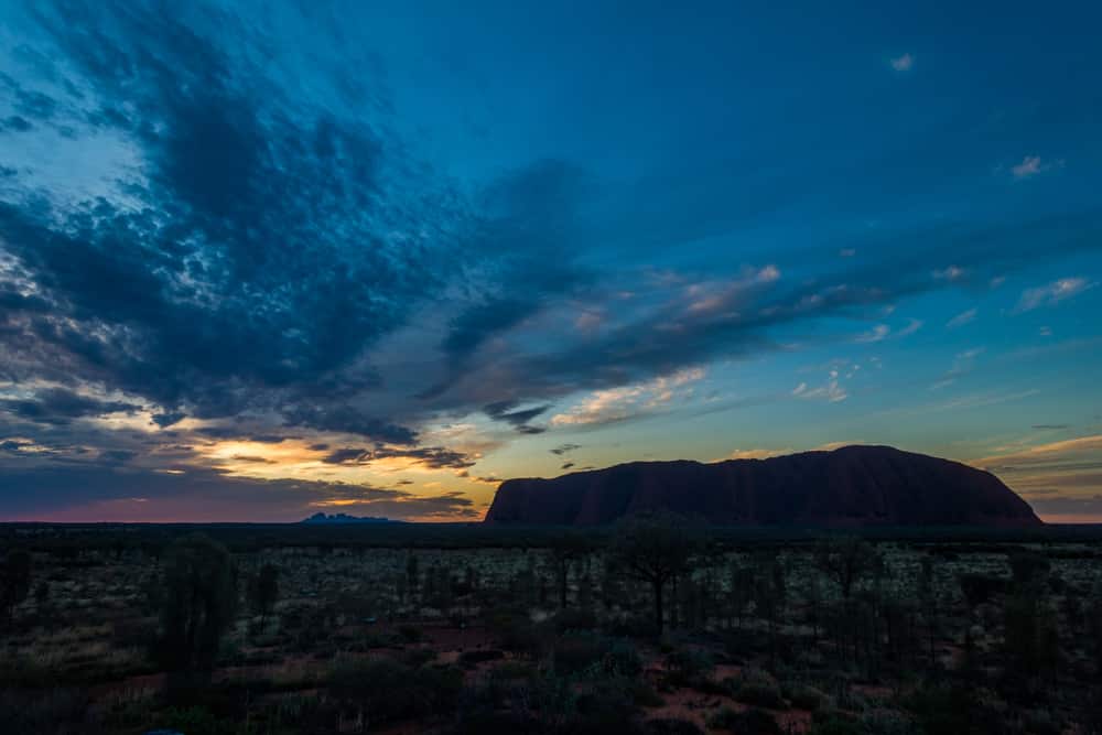
The highlights of our visit to Uluru-Kata Tjuta National Park are the Valley of the Winds Walk and the Uluru sunrise. We saw a Kata Tjuta sunrise as well, and sunsets from three different viewpoints, all breathtaking. The Uluru Base Walk was worth it as well, but can be skipped if you haven’t got enough time. For a more elaborate story about our explorations, some tips on surviving the extreme conditions at Uluru and stunning photos, we refer you to another blogpost, dedicated solely to our visit to Uluru-Kata Tjuta National Park.


Alice Springs
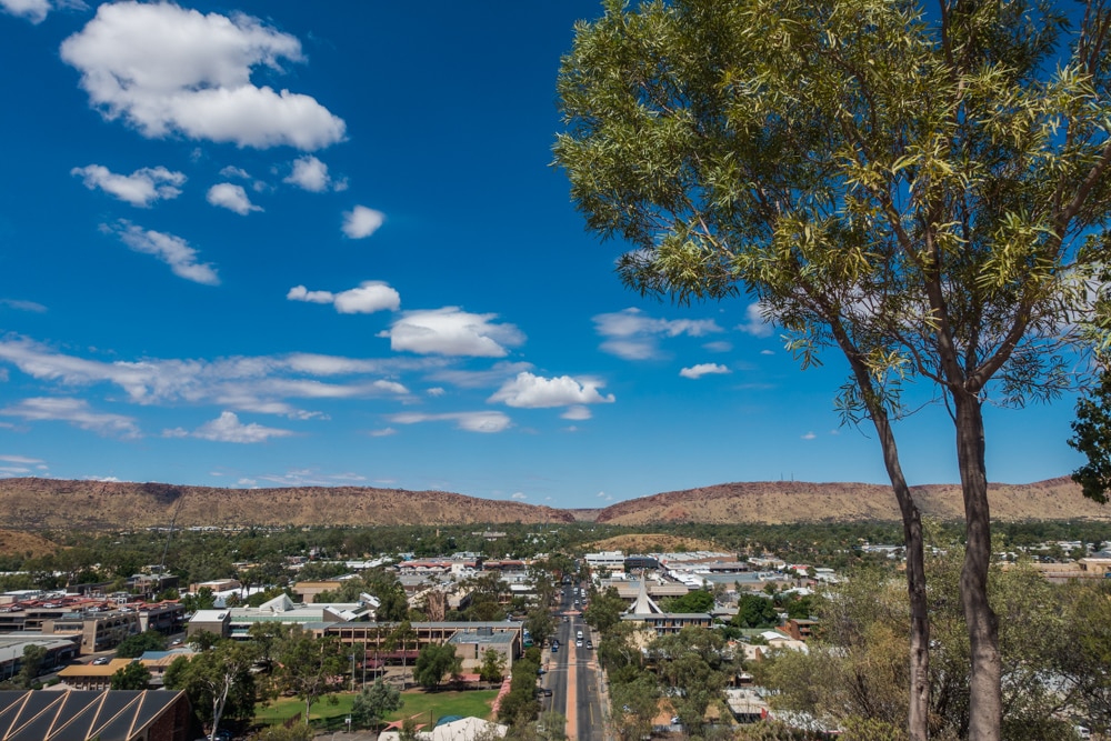
Alice Springs is the biggest town in the Australian Outback, situated almost 500 km north of Uluru-Kata Tjuta National Park. It’s full of Aboriginal culture, and surrounded by the MacDonnell Ranges. Finally we saw some green again instead of the red desert making up our view the previous days. During our three day visit, we climbed up to several viewpoints, and spotted some more Australian wildlife, both in the wild and at the Alice Springs Desert Park. Although the views were amazing, we didn’t really like Alice Springs as a city. According to Lonely Planet it is just one of those cities you either love or hate.
The first great view we encountered was in search for a geocache. Although the climb was a bit of a challenge, the view was worth it, looking out over Alice Springs and the MacDonnell Ranges. We saw lots of kangaroo poop, but unfortunately no kangaroos. The Anzac Hill Lookout makes for a beautiful view as well, and involves hardly any climbing, you can just drive up there. Anzac stands for Australian and New Zealand Army Corps, and the lookout is both a war memorial and a sacred place for Aboriginal people.


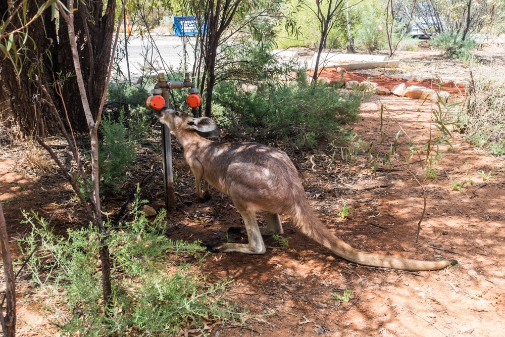
Another great view is to be seen from the River and Ranges Lookout at the Olive Pink Botanic Garden. When we arrived at the carpark, we saw two kangaroos hopping over to drink some water. So cute! We watched them for a while before climbing Meyers Hill to the viewpoint. The walk is really fun, but there’s no shade, so do wear a hat and sunscreen. If you’re lucky, you’ll see a kangaroo or two passing by. Left of the lookout there’s a bench to enjoy the view. The river was dry while we were there, but that can change quickly after some rain. On our way back down we got hungry and decided to have lunch at the Bean Tree Cafe in the park. Brecht had a salmon toastie ($10), I a cheese toastie ($8). Both were small, but quite nice. Brecht’s one had more flavour though. Anyway, it was a nice place for lunch and the lady working there was really friendly.
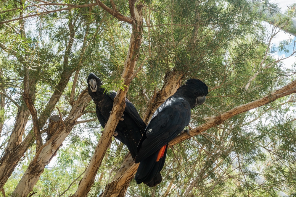
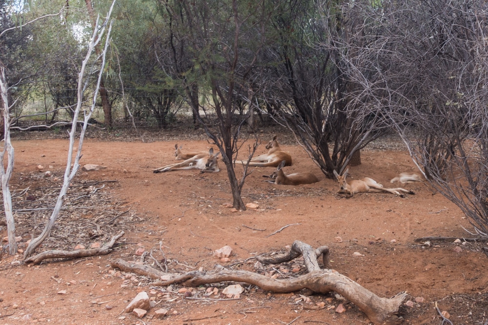
We can’t get enough of the Australian native wildlife, especially kangaroos, so we headed over to Alice Springs Desert Park. We paid a $25 entrance fee per person and started our walk through the park at about 13h. The park is nice and real big, but we liked Urimbirra Wildlife Park in Victor Harbour better. Nevertheless we spent almost the whole afternoon there. We saw dingos, lots of different birds, reptiles, and some lazy kangaroos. Guess it was too hot to hop around.


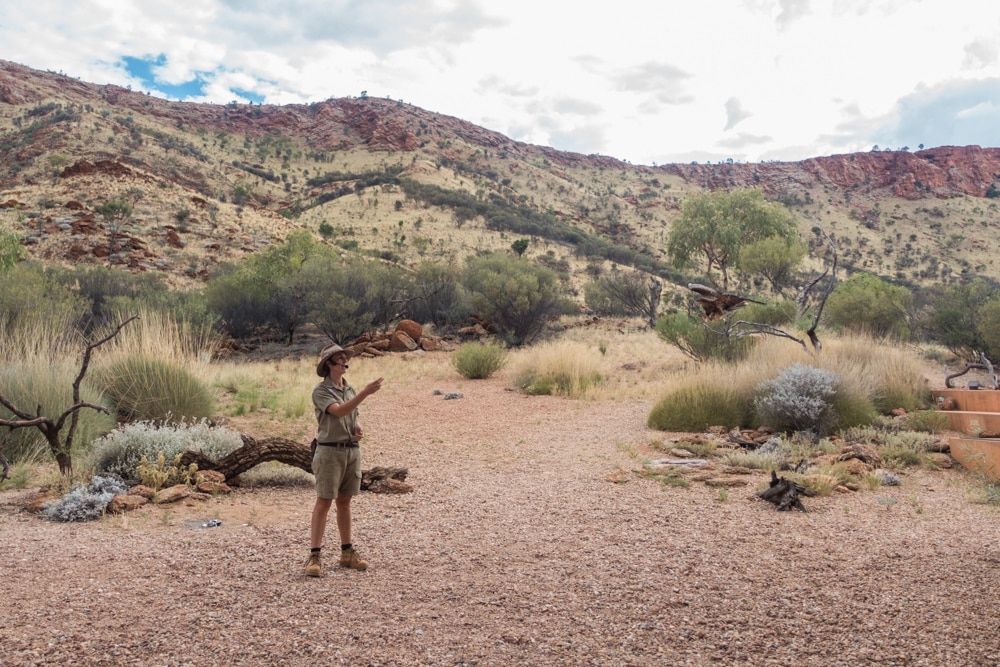
The highlights of our visit to Alice Springs Desert Park were the Australian Bustard and the Free Flying Bird Show. The Australian Bustard is probably the weirdest bird we have ever seen. He looked even more peculiar because he was “courting”, trying to impress the female. The bird show was great, filled with interesting information about kites (a kind of falcon) and other birds. The birds did some tricks as well, we were really impressed. For the rest of our trip we saw falcons flying over all the time. Not really sure if they weren’t there before or that we just didn’t notice them.
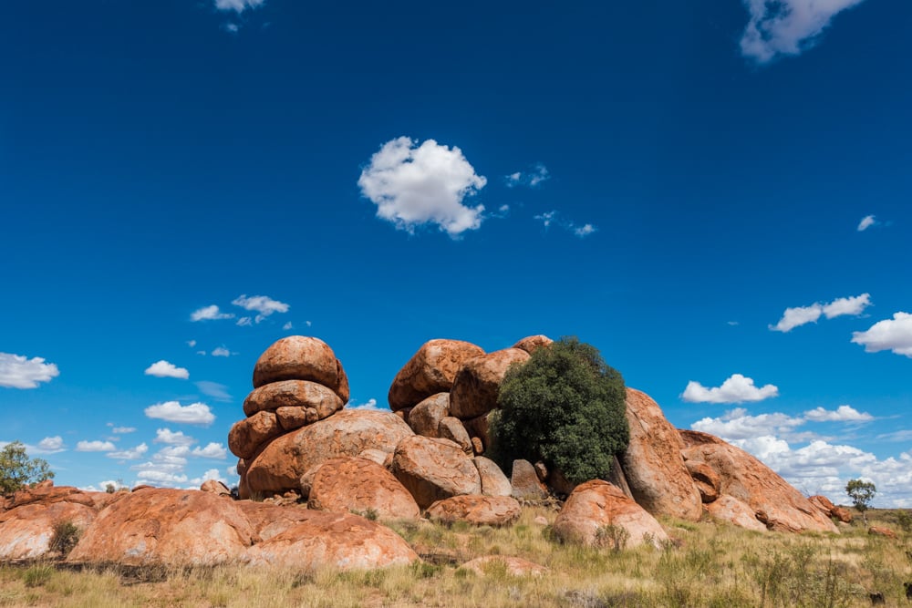
Karlu Karlu, Devils Marbles
On our way from Alice Springs to Tennant Creek, we made a short stop at Karlu Karlu or Devils Marbles. Karlu Karlu means round boulders, which is exactly what you’ll see at the Devils Marbles Conservation Reserve. The huge granite boulders are believed to be remnants of a solid mass of granite which eroded into what we now call Devils Marbles. To the Aboriginal people this is a sacred place, with its own story of how the granite marbles came to be. The weathering of the boulders still continues today, slowly changing the view. You can learn all about it from the information signs along the paths. It’s really fascinating how nature can create such peculiar shaped rocks and even split the marbles perfectly in two through rainwater filling the cracks. The views are absolutely stunning, definitely worth a stop! There are toilets and even free WiFi.


We really enjoyed our trip through Australia’s Red Centre, with Uluru-Kata Tjuta National Park our absolute favourite part. The views are amazing and the Valley of the Winds Walk was great. It’s just so special. Kings Canyon was wonderful as well, we really liked the Kings Canyon Rim Walk. When you’re visiting Australia, don’t miss out on the Red Centre. It’s truly unique, like you’re in another world. Do plan your visit well. Although it’s less crowded during summer, it gets really hot. 40°C and above. We survived our visit in March though, so it’s doable when you’re prepared to get up early. Enjoy!
Wat een leuke ervaring… vele mensen zullen jullie informatie kunnen gebruiken…